
West Ajijic / Sierra de San Juan Cosalá
Ceremonial Grounds (Western Route) via Río Nazas — Full Loop
Approximate metrics from the supplied GPX. Elevation totals are unsmoothed and include track fluctuations; no duration was recorded.
The route · GPX metrics
- Distance
- 4.20 km2.61 mi
- Elevation gain
- 886 m2,906 ft
- Elevation loss
- 886 m2,906 ft
- Max elevation
- 1,937 m6,355 ft
- Min elevation
- 1,590 m5,217 ft
Loop · Overgrown paths and a steep, loose descent
Trail notes.
Last updated
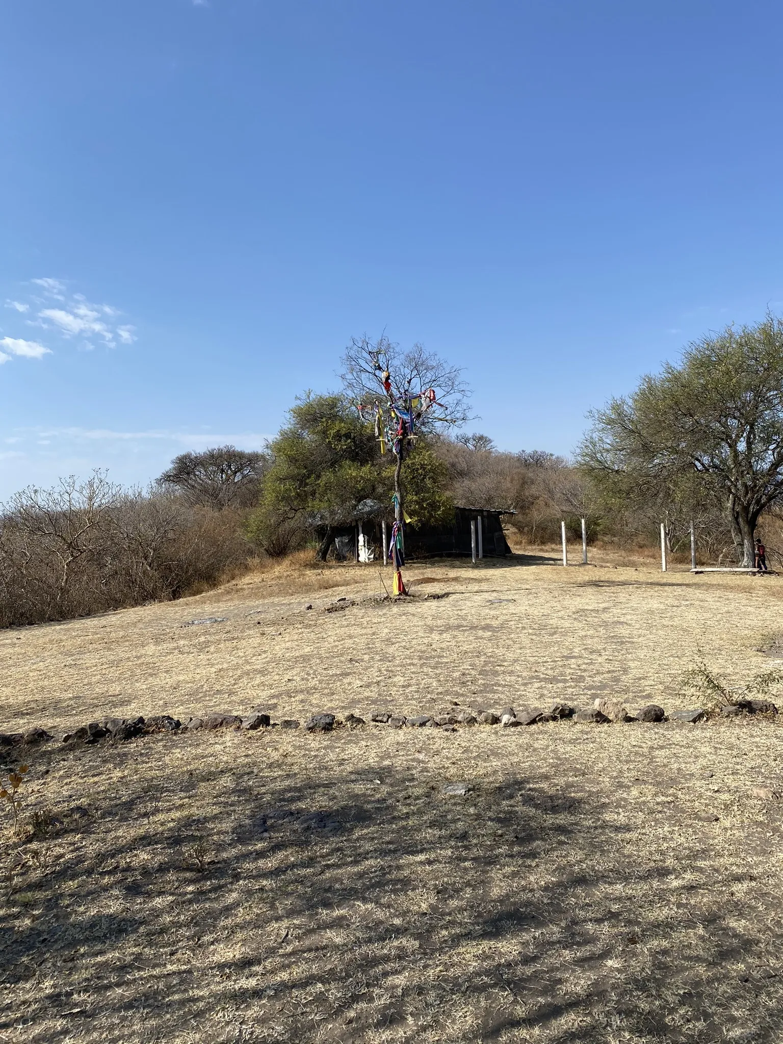
The Ceremonial Grounds is one of my favorite places in Ajijic, with fantastic views and a beautiful, little-used approach from the west. This loop climbs the Río Nazas ridge, crosses several arroyos, and passes through small pockets of forest before reaching the grounds. The return is a rougher affair: overgrown paths, some bushwhacking, and a steep descent on loose dirt through what appears to be an old oak forest.
01 / Parking
Parking on Río Nazas
Look for street parking near the top of Río Nazas, taking care not to block traffic or access. In 2026, I saw people parking on a grassy patch beside a red brick wall on the right side of the upper part of the street. That space may no longer be available by the time you read this.
02 / Finding the trailhead
Finding the trailhead
Walk uphill along the road as it curves left. At the fork, keep left rather than taking the right-hand road toward De la Montaña. Continue to the end of the road, where a clear trail branches off to the left. This leads to a junction connecting several trails in the area.
Along the route
If you’d rather skip the rough descent, you can return from the Ceremonial Grounds the same way you came.
From the junction, follow the GPX track east, then take the sharp left turn to climb the Río Nazas ridge. About an hour in, you’ll reach a small hill I call Little Elizabeth Hill. It’s an informal nickname; I haven’t found a name for it on any maps.
Continue down the other side and follow the fairly clear ridge path, with good views of the Sierra de San Juan Cosalá. Before long, you’ll reach another junction. One trail drops into an arroyo and climbs the neighboring ridge. A less obvious turn to the left follows a steep, unmaintained route up the Río Nazas ridge toward the summit ridge.
For this hike, pass both turnoffs and continue east toward the Ceremonial Grounds.
This stretch changes considerably with the seasons. During the rainy season, vegetation can obscure the trail almost completely and make it nearly impassable. Judge conditions according to your experience and ability, and be willing to turn back. In the dry season, the path is much easier to follow, crossing ridges, dipping into arroyos, and passing through small pockets of forest before climbing gently to the grounds.
Local people regularly gather here for ceremonies, so be respectful of the space and anyone using it. A local I met here told me camping was allowed, though I haven’t camped here myself. Check before planning an overnight stay, don’t overstay your welcome, and carry out your trash.
The return trail leaves to the south and can be difficult to find. It appears to be an established but neglected trail; finding it took me some searching and bushwhacking.
Look for an old horse stable building on the south side of the grounds. Beyond it, a path soon passes an outhouse on your left. Follow the GPX closely from here. The trail receives little apparent maintenance and is easy to lose in places.
After passing through brush, you’ll descend steeply into a sparse forest that I believe is mostly oak. The dirt is fine, loose, and very slippery. Take your time and watch your footing.
Farther down, you’ll come alongside a wire fence. Watch the GPX for a sharp turn west. That path crosses the forest and reaches a high ridge covered in thick, low brush. The trail can disappear into the vegetation here, so pay close attention to both the ground and your track.
From the ridge, the descent follows the property line south, where some old, worn ropes remain. Don’t count on those ropes for support. Another option is a short bushwhack west through the sparse woods. Either way, you’re aiming for the foot of the ridge and the arroyo below.
Cross the arroyo and pick up the straight, relatively flat trail beside a wire fence. This leads back to the original junction and your starting point at Río Nazas.
Another way to the grounds
Ceremonial Grounds (Western Route) via Río Nazas — Out and Back →